


METHODS OF INVESTIGATION
Successful assessment of dangers connected with failures of alpine lakes is based on detailed studies of their morphology and development. The lakes are surveyed in the field and their immediate state and its changes are recorded and assessed. The lakes at highest risk are monitored in long term and the achieved results evaluated.
A methodology tested and employed in studies undertaken by the Department of Physical Geography and Geoecology of Charles University has been used in studies of Mongolian lakes. The methods were adjusted to studies of alpine mostly glacial lakes. A set of geophysical methods has been used in studies of dams and their structures and contents.
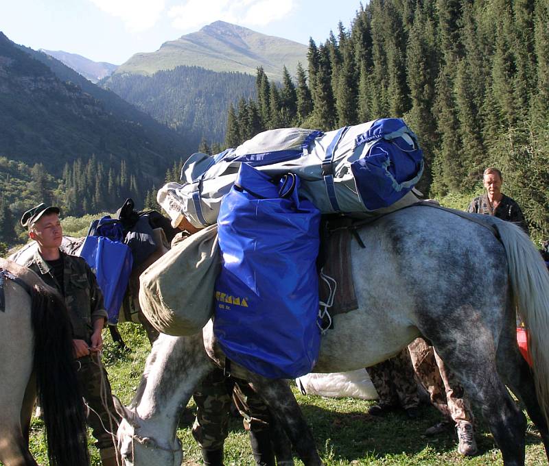
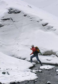
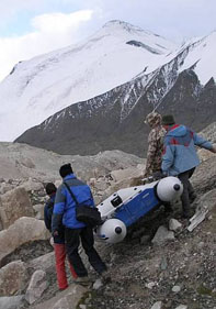
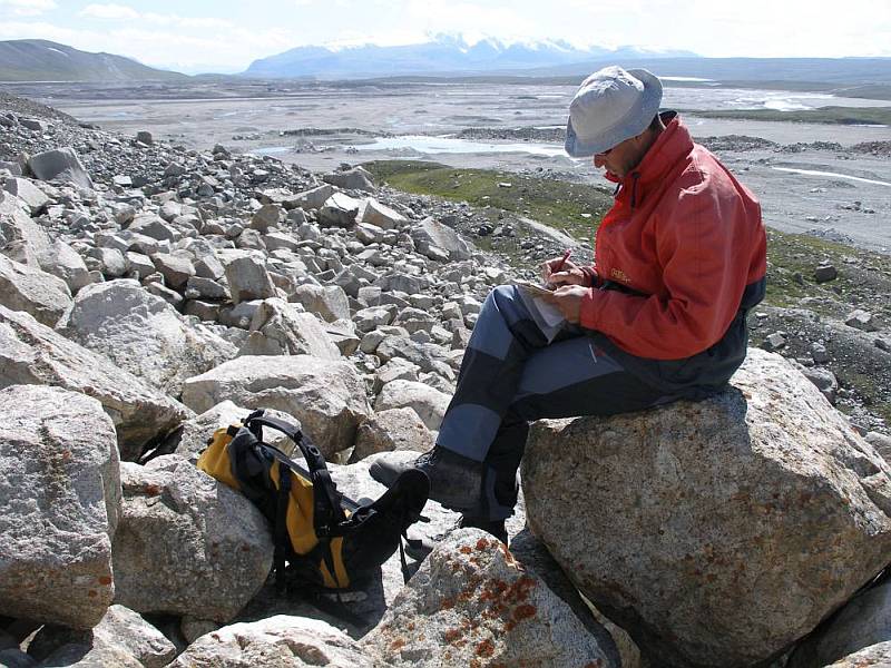
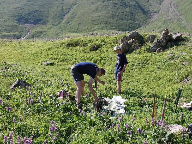
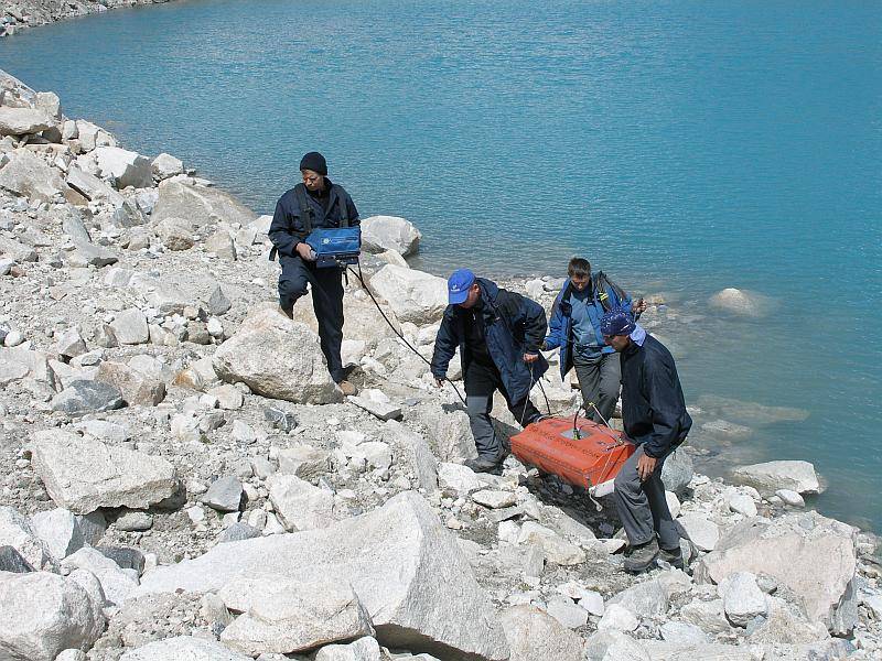
The field works were carried out by both the Czech experts and their Kyrgyz colleagues. The whole team during the field operations consisted of 12 – 14 persons. The studies were performed through visits and inspections of individual lakes lasting 2 – 8 days each. A jeep (model UAZ) and a Mercedes van usually used for passenger services were used. The material and gear from a place accessible by jeep was then transported to the basic camp on hired horses and then carried by team members and hired local porters to the lake. The works given below were carried out simultaneously.
Methods of bathymetric mapping of selected lakes
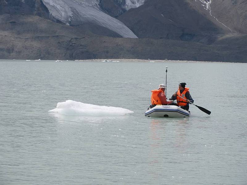
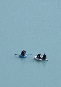
Bathymetric survey of selected lakes was carried out using a total geodetic station Leica TCR, depth echo-sounder Garmin Fishfinder 240, rubber dinghy and solid thin fishing line which does not stretch with length. The measurements are carried out along parallel profiles across the lake that are staked out according to geodetic orientation points on the lake shore. The boat with echo-sounder sails along a cord stretched between the two orientation points and the depth is measured in regular intervals. The accuracy of bathymetry using the echo-sounder depends on the measured depth. Based on gathered experience, in comparison with values obtained using a weight on calibrated cord lowered to the bottom, it can be pointed out that the accuracy of measuring to depths of 50 m corresponds to max. 10 cm.
Bathymetry of the Petrova lake, due to its size, was undertaken differently from the above- mentioned method. The boat was equipped with suspended engine Tohatsu and a sonar with GPS receiver Garmin GPSMAP 178C Sounder was used for depth measurements. All the bathymetric data together with coordinates were automatically stored. The measurements of the shoreline using the geodetic station turned out to be too complicated and time consuming so that the satellite imagery QuickBird was used to define the lake shoreline. Its resolution of 70 cm vs the lake dimensions was found to be satisfactory and accurate enough.
Methodology of water discharge measurements
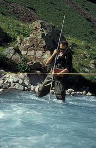
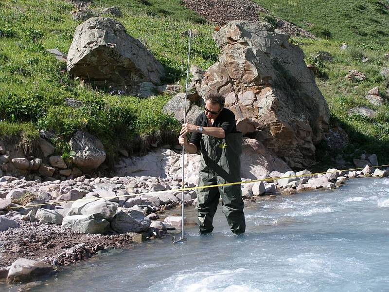
Measurements of water discharge were always carried out using a current meter. Two instruments were available which differed from each other by the size of the propeller. Smaller propeller was used in streams showing lower discharge (shallower streams) in which larger current meter (propeller 10 cm in diameter) could not been used, based upon experience gathered during the last year field operations.
The measurements were done in harmony with the valid standard according to which the discharge velocity is measured along several profiles the number of which depends on the width of the stream. The depth and width of the riverbed is simultaneously measured that serves for determination of the area of partial discharge profiles. The discharge is then calculated as a sum of discharges of sub- profiles, which are defined by the sum of discharge profile and flow velocity.
Additional measurements and observations
Meteorological observations
Meteorological observations
Basic meteorological parameters were always measured at the field camp. The air temperature was measured three times a day (at 7:00, 14:00, 21:00) using a digital thermometer with 0.1oC accuracy of measurement. The daily atmospheric precipitation totals were measured by means of special portable plastic (for its light weight) rain gauge. The accumulated atmospheric water was transferred into measuring cylinder with 2 ml marks.
Measurements of physical parameters of water
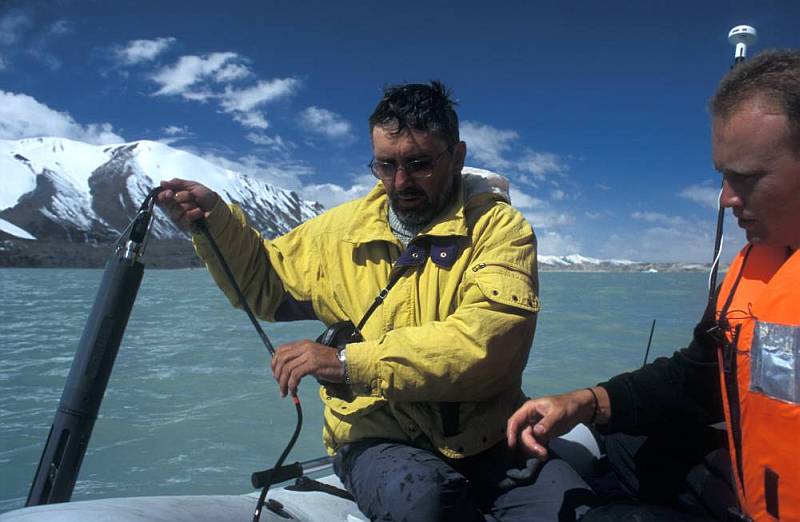
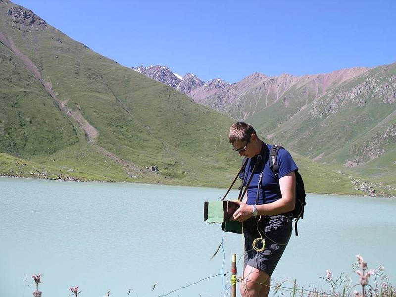
A multi-parameter probe YSI 6920 was employed to measure the basic physical parameters of accumulated and running water (temperature, conductivity, pH, amount of dissolved oxygen, total dissolved salts, oxidation-reduction potential). Changes in all parameters in the course of single day (in 15 min. intervals) were recorded by adequately programmed probe that was immersed in the stream. Measurements in vertical column of water at an interval of 0.5 – 1 m above the deepest point of the lake were also carried out. The transparency and color of water were established using the Secchi’s plate and Forel-Ulle’s color scale.
Biological sampling
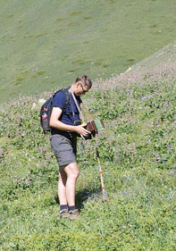
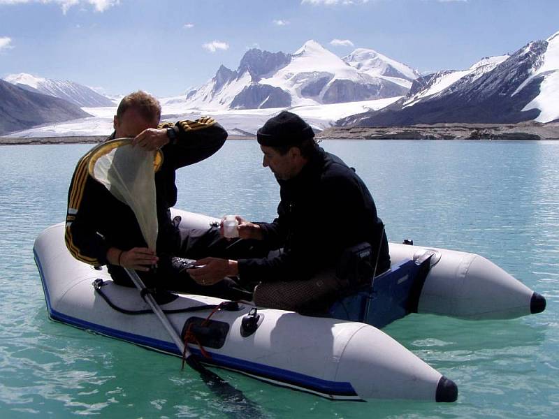
A sample of plankton was collected from the whole of water column in place of the greatest depth in the studied lakes.
Survey of the lake shoreline by means of the total geodetic station
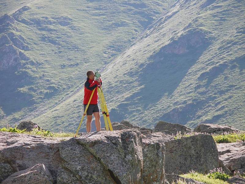
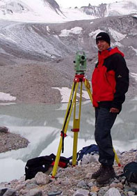
The total geodetic station Leica TCR 705 was used for all geodetic measurements. The survey of the whole of water surface can be done from several stand points ( in the case of smaller or easy to survey lakes even from one stand point) appears to be the major advantage of the total geodetic station. Therefore, it is of utmost importance to select the best stand points (polygonal points) from which the largest possible length of the shoreline can be seen.
The initial sight line of the station is done by reflecting prism that is moved by a helper along the shoreline. The distribution of measured points on the shoreline is more or less regular but depends also on the contour and shape of shoreline.
A ground plan of moraine or caved in dam, position and/or the path of discharge were surveyed at some lakes in addition to the survey of the shoreline. Geophysical profiles of dams were also staked out by surveying.
Geomorphological mapping
Data that were largely acquired by mapping in the field were the basic and initial source for assessment of geomorphological phenomena endangering individual lakes. The basic objective of geomorphological survey was to establish the spatial distribution of erosional and accumulation forms of the relief, their relation to the recent morphological processes and qualitative characteristics of hazardous geomorpholgical features and processes.
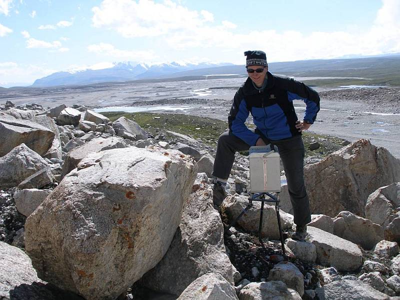
Appropriate aerial photographs and topographic maps at a scale of 1:25 000 were used for mapping of landforms. The GPS instrument was used for precise localization of hazardous manifestations of geomorphological features and processes, while other landforms were, because of time pressure, plotted on maps by traditional methods, i.e. without GPS data.
Once the field mapping was concluded the maps compiled in the field were transferred into GIS. Hand drawn (analogue) geomorphological maps were transferred into digital form using indirect autotrace method. GPS data were converted into format of spatial databases.
Morphological analysis of the relief
The analysis is based on the compiled geomorphological map and field observations of landforms. Areas of erosion and accumulation relief and their share in the total area studied were defined and outlined in the environs of individual lakes after assessment of geomorphological dangers. The major risk factors were established in individual areas including assessment of their possible role in endangering the lakes. The overall evaluation of geomorphological risk factors will be undertaken after completion of the analysis of historical glaciation and recent processes of slope deformations.
The engineering-geological and hydrogeological investigations were carried out without technical means and were focused on studies of conditions of dams and hydrogeological conditions of individual lakes and their tributaries. Results of other studies were also taken into consideration when assessing the current state of affairs.
The lake dams and lake environs were inspected during the field operations. The conditions and composition of the given dam were assessed. Special attention was paid to all signs of dam deformation or damage, erosion furrows and landslides. The existing conditions were confronted with those found during the last inspection which was undertaken by Mr. Sergey Yerokhin and also by our research team in several cases. The closest surroundings of the lake, the adjacent slopes and continuation of the moraine towards the glacier were observed in particular. Manifestations of landslides and streams of debris avalanches, which in the future may affect the development of the lake basin or result in a sudden increase of water level and subsequent bursts of water, were studied and recorded. The glacier recession and morphological changes in its snout and in moraine were monitored and studied in the case of moraine-glacial lakes.
Hydrogeological investigations were focused on the assessment of immediate state of the lake basin. The conditions and character of inflow and discharge were studied in particular. Some changes in morphology and shape of the lake basin and changes in hydrogeological characteristics were identified and recorded since the last inspection.
Geophysical methods are routinely used in exploration of natural and constructed dams. The methods are based on measurements of physical properties of materials the dams consist of and their bottoms and bedrock. The shape and physical conditions of individual geological beds which the dam is built of, demarcation and definition of local heterogeneities of the studied environment (e.g. moist places, porous zones and cavities, existence of ice, etc) can be established and derived from the interpretation of data acquired by geophysical measurements.
When designing and selecting geophysical methods for exploration of lake dams in extreme alpine environment a realistic support of the expedition is to be considered. Therefore, “unsophisticated” geophysical methods are preferred because of little demands on technical backup.
As mentioned above, one of the objectives of geophysical measurements is to obtain detailed information on the structure of dams, their homogeneity and permeability. The following complex of geophysical methods was selected for the scheduled exploration:
The VES method (vertical electric sounding)
and the MEM method (multiple electrode method) provide information on vertical resistivity of the dams structure. The classic VES method gives spot information on the vertical structure. Its advantage lies in little demands on instrumentation and high mobility of measurements.
The SOP method (symetric resistance profiling)
supplements the VES method in places where detailed measurements using the MEM method will not be undertaken The combination of VES and SOP methods will also be used as a backup method if the more accurate MEM method will not by applied due to extremely high resistivities in ice containing part of the dam.
The DEMP method (dipole electromagnetic profiling)
s a very reliable and responsive method in search for local conductive zones that often correspond to fractures in glaciers and sites with leakages. This method is a basic means for monitoring anomalies detected in 2005.
The SP method (spontaneous polarization)
is suitable for detection of leakage of water (its filtration) through the dam body. During percolation and filtration of water in porous environment the anions accumulate in place of infiltration, while cations concentrate in place of outflow. The electric field originating due to this redistribution of ions dissolved in water is measured by SP method. This method will also be used in monitoring anomalies detected in 2005.
Microgravimetry (MG)
is a method used for measurements of density of material constituting the dams. The measured gravity values stripped of noises – latitude and elevation corrections, etc. (the so-called Bouguer anomalies) are used for construction of a gravity model of the environment at the site of measurements. Combination of resistivity and gravity values and/or anomalies provides results in better interpretation and more accurate definition of the given dam.
Ground penetration radar GPR
operates on the same principle as any radar: It is emitting electromagnetic waves towards the earth and the energy, which is scattered back by reflecting objects having different value of wave resistance (dielectric constant, resistivity) relative to surrounding environment is detected. This method was used in search for location of massif ice, fractures in ice and analogous local heterogeneities. High resolution is the major advantage of this method.
The assessment and interpretation of acquired data and measurements undertaken during the field operations are partly carried out in Kyrkyzstan but largely in the Czech Republic. Experts of the GEOMIN Company in Jihlava and the Department of Physical Geography and Geoecology of the Faculty of Science, Charles University, Prague, participate in these works.


The evaluation of undertaken studies is focused on:
-
compilation of a map of the lake and 3D model of the lake basin
-
compilation of geomorphological map of the close environs of the lake and the glacier snout
-
compilation of geomorphological map of the valley
-
calculation of cubic capacity of the lake
-
appraisal of maximum discharge in the case of breakout of water
-
risk analysis of the valley
-
proposal for further monitoring, and/or warning system and technical solution
-
assessment of climate change effects on the studied phenomena