


PROJECT RESULTS
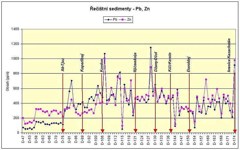
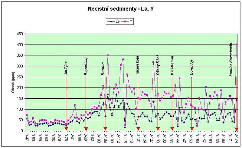
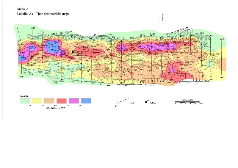
The catastrophic failure of tailings pond No.2 in 1964 actually predetermined the environmental situation in the Kichi-Kemin river valley from the Ak-Tyuz village down stream to the state border with Kazakhstan and probably even further. The analyses of samples collected showed that stream sediment and heavy mineral surveys, soil geochemistry and gamma spectrometry are methods which can provide reliable information, and relics of radioactive tailings also containing heavy metals to be identified and mapped so that their areal extent can be defined. Progressive increase in contamination of sediments by some elements below the village of Ak-Tyuz (tailings pond No.2) was confirmed. These elements are characteristic of mineral assemblages contained in ores extracted from the local mineral deposit. They include Pb - Zn, La - Y, Th and some others, such as Zr, W and Be. High contents continue to occur through the villages of Kichi-Kemin and Boroldoy as far as the border with Kazakhstan. Considerable variations in the concentrations of individual elements (sudden alternation of high and low contents) are characteristic and seem to reflect changes in the proportion of wastes in stream sediments. On the other hand, contents of single elements upstream from the village of Ak-Tyuz are mostly uniform and most probably reflect the natural background derived from the local rocks.
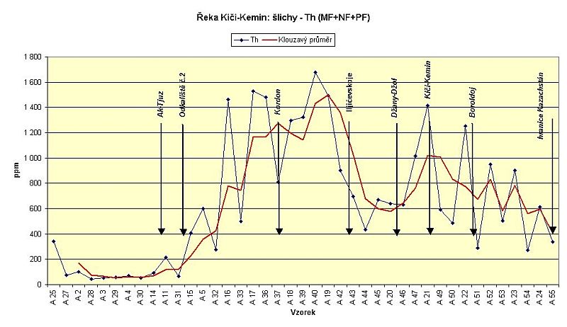
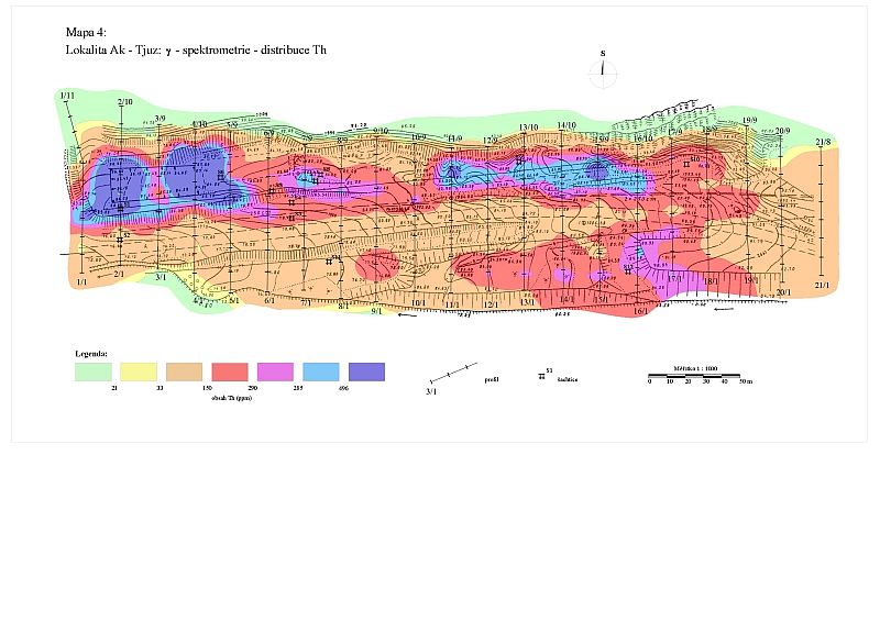
A similar trend can be seen in the distribution of Th in concentrates of heavy minerals.
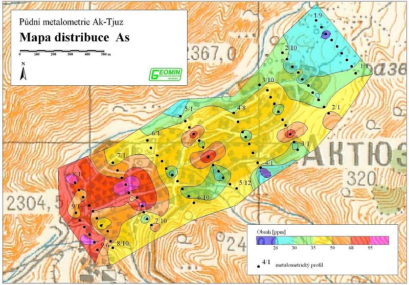
Soil geochemistry at the Ak-Tyuz site. Altogether 85 soil samples on 9 profiles based on a 250 x 50 m grid were collected. The whole territory of the village at a distance of ca 2 km from the abandoned concentrator in the SW as far as the cemetery on the NE edge of the area investigated, which is already outside the settlement, was covered by soil geochemistry. All sampling sites were also measured using surface dosimetry and gamma spectrometry (Th, U, K). The survey was designed to determine the level of contamination of soils by heavy metals and radionuclides.
The distribution of selected contaminant metals, specifically As, Be, Cu, Mo, Pb and Zn appears to be homogeneous. Marked anomalies of these elements were detected in the SW part of the village in the area immediately linked with the former concentrator and tailings pond No.1 (unambiguous source of contamination). These anomalies become gradually less pronounced towards the north-west with increasing distance from the tailings pond and finally vanish at the NE margin of the area surveyed (profiles 1 and 2).
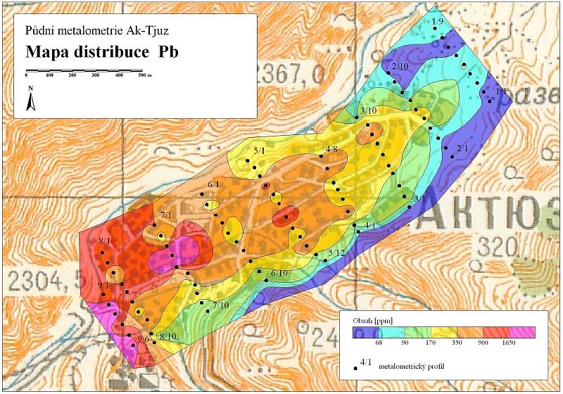
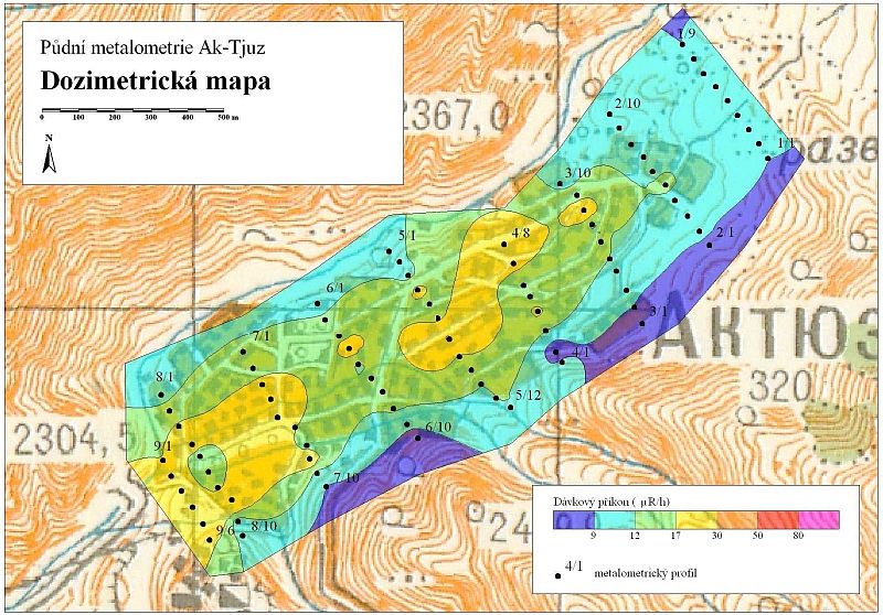
As follows from maps of element distribution, arsenic and lead are the major pollutants. High concentrations exceeding the safe limits set for sites of housing development are found over large areas posing significant risks to the health of the local population.
Radioactive elements measured by gamma ray spectrometry show a pattern of distribution similar to that shown by heavy metals. Enhanced contents of radioactive elements again tend to extend from SE to NW across the Ak-Tyuz settlement and their concentrations decrease in the same direction. However, the slightly anomalous values depicted in the dosimetric map do not exceed the safe standard equal to 50uR/hr.
Based on the spatial distribution and the trends in increased and anomalous contents of elements it can be assumed that the migration of heavy metals in the area of Ak-Tyuz village is likely to have been caused by aeolian transport of dust from the concentrator, open cast mine workings and from tailings ponds.
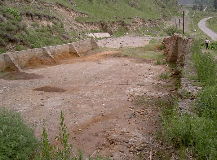
2) Remediation of radioactive contamination – former storehouse of Th-REE concentrate
The remediation of this small source of radioactive element contamination was undertaken in the years 2004-2005.
The procedure of the work was as follows:
-
Definition of the project objective – designed by the GEORISK Company in 2002. This proposal has then been incorporated in the project for Foreign technical aid directed to the Kyrgyz Republic by the Czech Republic.
-
designed by the GEORISK Company in 2002. This proposal has then been incorporated in the project for Foreign technical aid directed to the Kyrgyz Republic by the Czech Republic.
-
Assessment of the project objective, its concept and technical resolution by the license holder for design, remediation and handling of radioactive waste (VNIPI Moscow)
-
Compilation of a topographic map at 1:1 000 scale of the warehouse and its immediate environs, an area of 400 x 100 m, i.e. ca 4 ha
-
Marking out profile grid for radiometric measurements. The distance between profiles was 20 m, measuring sites were 10 m apart. Altogether 21 profiles were staked out and 195 points measured.
-
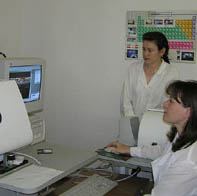
Dosimetric and gamma-spectrometric measurements on the profiles. A spectrometer model GR-130 was used for measurements. Dosimetry – exposure time of dose rate was 2 seconds, g-spectrometry – exposure time 600 seconds, total count measurement and contents of Th, U and K were determined,
-
Compilation of radiometric maps – dosimetry and map of distribution of Th , U, K and total y-activity,
-
Digging of 12 shallow exploration pits (total footage 13.3 m) to establish the depth limit of radioactive contamination. Measurement of dose rate was carried out at 10 cm depth intervals in pits. 18 samples were collected for determination of Th, U, K and heavy metals
-
Design of the first stage in the execution of the project aimed at clearing the radioactive contamination (VNIPI Moscow)
-
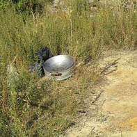
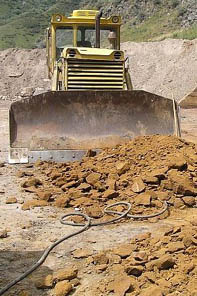
October 2004 – implementation of the first stage of clearance operations. Ca 1 000 cu.m of contaminated ground were scraped and re-deposited in the tailings pond No.3 nearby
-
Design of the second stage of execution of the project to remove radioactive contamination (VNIP Moscow)
-
July – September 2005 – implementation of the second stage of clearance operations. Ca 2 600 cu.m of contaminated material were removed and deposited in settling pond No. 3 nearby. The area of the former storehouse was levelled. Photographic documentation of remedial works is shown in Figs 22 – 35 of the GALLERY
-
Final acceptance of work undertaken including checking dosimetric measurements (September 21, 2005)
-
A comprehensive assessment and interpretation of all data acquired during the implementation of the project was carried out in 2006, and the whole undertaking are concluded by presentation of the Final Report
Jihlava, 2006
Project manager: RNDr. Miloš Abraham, phone. +420 567161258, E-mail:
abraham@geomin.cz