COURSE OF WORK 2004-2007
INVESTIGATIONS UNDERTAKEN DURING THE PROJECT
The program of field work began in 2004, but the main period of investigation of the different types of lakes during which field methods were tested and verified was carried out in 2005. Detailed studies of selected lakes will be completed in 2006, the final year of the project. The results was interpreted and the Final Report compiled and delivered to the Ministry of Environment of the Czech Republic and the Kyrgyz state authorities. The results will be prepared for publication in the relevant professional journals.
WORK UNDERTAKEN IN 2004
The field operations in 2004 were concerned with the reconnaissance of the major types of alpine glacial lakes in the mountain ranges of the western and central Tian Shan and an assessment of the levels of danger from failure and flooding.
The following studies were carried out on individual lakes:
-
comparison of the present situation with respect to that observed during the last monitoring
-
assessment of the range of oscillation of water level, changes in shoreline and adjacent slopes, changes in inflow and discharge, and the relative position of the glacier and its front
-
measurements of water discharge using a current meter
-
monitoring hazards which could arise from landslides and debris-flows and studies of their potential impacts
-
compilation of a comprehensive database of information on all lakes studied in the past, together with new information being gathered, including meteorological data
-
the most appropriate lakes and valleys were selected for study during the coming years
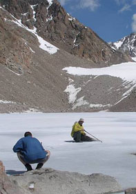
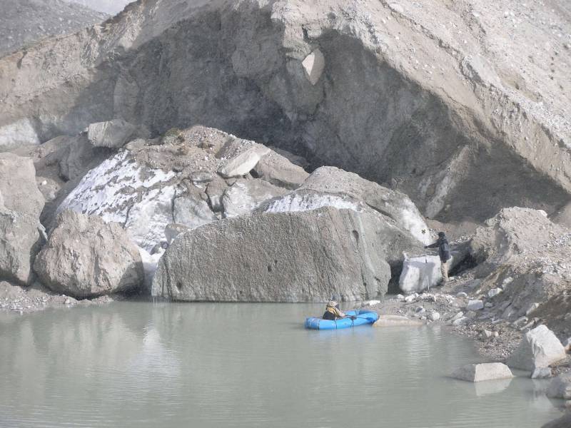
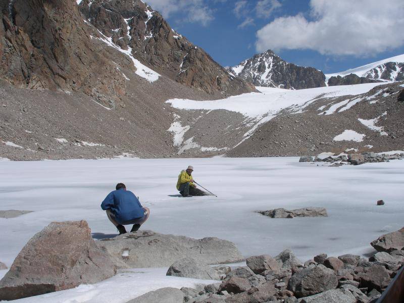
Altogether 7 localities were investigated during the two months of fieldwork in summer 2005
The following investigations were undertaken:
-
bathymetric measurements of the lake basin
-
surveying of the shoreline
-
measurements of inflow and/or discharge
-
measurements of the physical parameters of lake water
-
collection of biological samples
-
meteorological observations
-
engineering geological and hydrogeological assessment
-
geomorphological mapping
-
geophysical surveys using a combination of methods
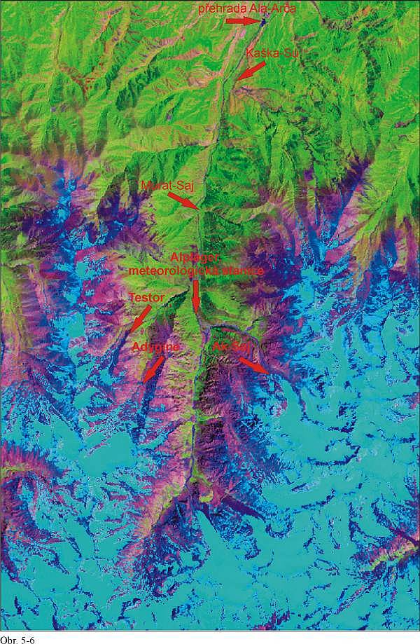
The Geomin team, together with the Swiss South-North team, visited the Sokoluk valley in 2004. The project here is focused on the management of mountain valleys and, as part of the investigation of mountain climate, changes in the ice cap are also monitored. The joint mission surveyed the valley to identify sites at risk from debris-flows and visited glacial moraine lakes in the upper part of the valley.
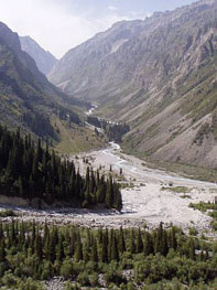
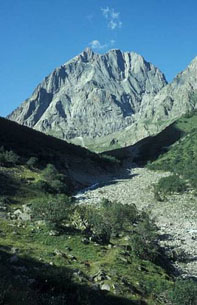
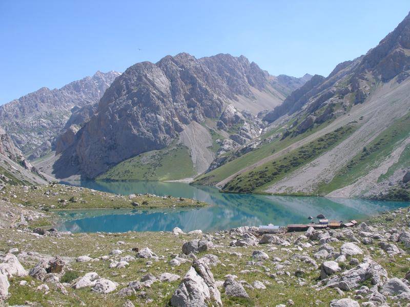
The Ala Archa valley is the nearest and best known valley on the northern flank of the Kyrgyz range. A National Park covering an area of 120 000 hectares has been established here since 1976. The Park is to protect the alluvial plain as well as the head of the main valley and several side valleys. The range is strongly glaciated, even though a marked retreat of glaciers has taken place over the last decades. An asphalt road leads through the main gate into the central part of the park. There is a parking lot in front the second gate inside the park, and the last two kilometers are accessible only by special permit. A hotel, though infrequently used and not very attractively designed, together with a weekend residence of President Bakiev are located here.
The area is frequently visited by tourists, mainly in the lower parts and areas adjacent to the road. It is a popular venue for Bishkek residents, visited mostly during the summer months. The spectacular peak of Korona ( 4 692 m above sea level) and the highest peak of the whole mountain range – Pik Semionova Tianshanskekho (4 895 m a.s.l.) are visible nearby.
There is a mountain hut named Racek after a Czech alpinist who introduced and established the alpine tradition in Kyrgyzstan during the thirties of the last century. The area is at risk from several natural phenomena among which landslides are most frequent, together with debris-flows coming from side valleys every year. A debris-flow occurred on July 21, 2003.It came from the Kashka-Su valley and flooded the local village and adjacent recreation area with a stream of rocks and boulders more than one meter thick. Another large debris-flow affected the same village on July 18, 2004, destroying newly reconstructed houses. A second locality recently affected is at the mouth of the Karagai-Bulag valley where a debris-flow occurred on July 25, 2003, completely destroying a pool used for fish farming, damaging a hunting lodge and destroying a road connecting Bishkek and Ala Archa. The same site was also hit by a smaller debris-flow in 2004. The Ak-Say valley is the third locality frequently stricken by debris-flows that take place both after torrential rains, and due to the periodical rupture of a lake dam formed in front of the Ak-Say glacier. This valley is regarded as one of the most dangerous. In the case of a large debris-flow, there is a threat to the entire infrastructure around the park entrance, thus obstructing entrance to the central part, including accommodation facilities and the presidential residence.
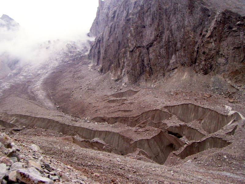
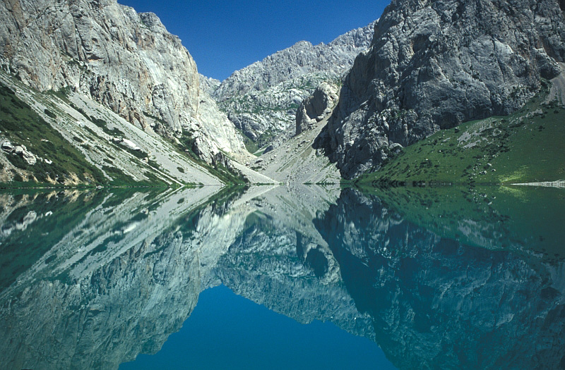
The Ak-Sai valley and glacier
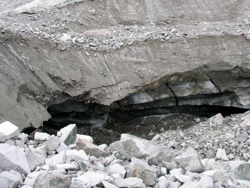
A deep conical depression has formed in front of the glacier. This is periodically filled with water. The processes are chaotic. If the discharge channels remain open, then the depression remains dry and does not pose any danger. First the glacial melt waters are drained from the central part through this complex of channels via two siphons to flow through an underground channel for about 400 meters, then emerging on the surface in the form of a large rising spring. If this underground channel is blocked, then the depression can be filled with water to create a lake with a volume of cca 100 000 m3. In this case, after the lake is completely filled, it may burst, giving rise to debris-flows in the central and lower parts of the valley. The discharge during a breakout is usually about 20 m3/s but may be even greater. Ruptures occurred in the years 1960, 1961, 1965, 1966, 1968, 1969 and 1970. At present, the situation is temporarily stable, but it is likely that the hydraulic pressure is just building up progressively so that a new failure will take place. According to S. Jerokhin “this lake has still not said its last word”. It is considered to be one of the most dangerous lakes within the entire Kyrgyz range. A reconnaissance of the glacier front and adjacent depression was undertaken in 2004. The year after the depression was surveyed, a model was created and the volume of the contained lake was calculated. The depression was dry during the two visits and the channels were found to be open and the supply of water from glacier was low.
Detailed investigations continued in 2005. This included a topographical survey of the depression and measurement of its capacity. A number of scout profiles were marked out across the valley. Geomorphological study of the moraine and the front of the glacier was also carried out.
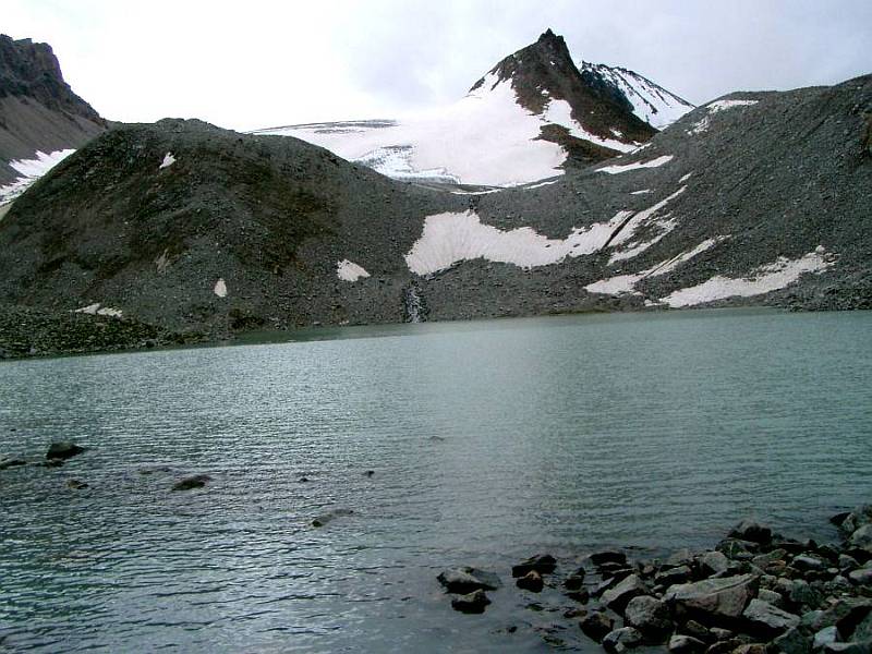
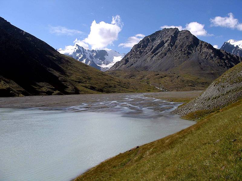
Lakes in the Adygine and Testor valleys
The Adygine lakes form a part of the glacial moraine complex of the Adygine glacier in the source area of the Adygine river. This is the left tributary supplying the main flow of water to the river Ala-Archa.
The lakes were visited in the years 2004, 2005 and 2006. A reconnaissance was undertaken in the first year so that the conditions found could be compared with those observed during earlier inspections. Bathymetric measurements and surveying of the shoreline were done in 2005. The front of the glacier and new lakes were documented and surveyed using a GPS.
The Upper Adygine lake lies at an altitude of 3 595 m above sea level in front of the glacier tongue of the same name. The lake is formed in a large depression inside an active moraine. A dam is formed by a solid rock bar that is strongly eroded and dissected into a few larger blocks of rock at the site of outflow. This alpine lake is relatively deep. Depths greater than 15 m were measured over more than half the area of the lake. The maximum depth measured was 21.6 m.
The lake is drained through channels, both underground and on surface. The water overflows the weathered rock bar over a width of about 3 m during the summer, but during the winter the lake is drained through underground channels. The course of these is unknown.
The water from the Upper Adygine lake supplies the Lower Adygine lake which occupies a thermokarst depression cca 50 m deep and 150 m long. In addition to the surface inflow, the lake is probably supplied by water via an underground channel. The capacity of the Lower lake fluctuates widely during the day within the range of 10 000 and 15 000 m3. The maximum depth of the lake measured in 2005 was 4.7 m. On August 2, 2005, the measured water level rose by about 80 cm between 09.00 hr and 16.00 hr. Large fluctuations of the water level are likely to be due to the capacity and permeability of underground channels through which the Upper lake is drained. The inflow of water into the Lower lake must increase progressively or the Upper lake dam would break. The lower basin can accommodate more than 500 000 m3 of water. The rupture of such a large depression would cause a great disaster in the main valley of Ala-Archa.
In addition to the two lakes above-mentioned, three other lakes of smaller size are being formed in front of the retreating Adygine glacier. These lakes are not currently at risk of failure but their development is expected to continue actively. The whole cascade of lakes poses a great danger for the future. This is demonstrated by the small lake which existed before July 2005 in front of the westerly tongue of the glacier. At this time it burst, the process being documented in exposed underground channels which extend into deep underground siphons. This lake had a capacity of around 100 000 m3.
Three basins occupied by lakes exist in the source area of the river Testor that forms the left tributary of the river Adygine. The lakes are designated Testor 1 located at an altitude of 3 590 m above sea level, Testor 2 at 3 580 m a.s.l. and Testor 3 at an altitude of 3 550 m a.s.l. The lake outbursted in 1998.
The first two lakes formed in thermokarst depressions, whereas the third lake flooded a depression inside the active moraine. Before 2004, The first two lakes were considered stable bodies of water because there was little fluctuation in their capacity. However, the volume of lake Testor 1 has grown during the last few years. In 2003 it was about 25 000 m3 and one year later the capacity reached about 50 000 m3. On July 8 – 10, 2005, when the capacity was estimated to exceed 70 000 m3, the lake burst open through underground channels. The escape of water through these underground channels was gradual, having no catastrophic impact, however, the water discharged into the river Testor reached as much as 6 – 8 m3/s. Increased water discharge was also recorded in the main Ala-Archa valley where one bridge was destroyed and a few weekend houses were flooded. The rupture also disturbed a part of the moraine containing small thermokarst lakes. During the period of our survey on August 4, 2005, the lake basin was dry, and occupied by numerous blocks of rock. At the site of rupture there is a depression about 10 m deep resembling a cave, the walls of which are formed by buried ice. The lake Testor 2 with a capacity of 5 000 m3 emptied at about the same time.
The dry lake basin at the Testor site was surveyed and the conditions of small thermokarst lakes and the glacier tongue close to the main moraine were studied and documented.
Lakes in the Kegety valley (Chu region)
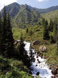
The Kegety valley is located about 60 km east of the city of Bishkek, south of the town of Tokmok which is the administrative center of the Chu region. The Kegety valley itself, which opens near a village of the same name, is about 30 km long running roughly NNE-SSW. After about 10 km the valley joins the Koltor valley that runs almost parallel in a N-S direction. After the next 9 km the valley divides into the Kegety proper and the westerly At-Dzhailoo valley. Numerous short and steep sided valleys and gullies, most of which contain creeks, open into all major valleys. The picturesque Pigeon waterfall is a popular picnic site in the valley.
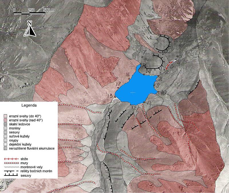
The lake probably formed during the daun stage of development as a moraine lake, and the lake basin is thought to have been shallow at the beginning. During the subsequent stage the moraine was covered by a massive landslide of rock from the right side of the valley and later another small landslide occurred from the left side of the valley. In this way the dam was strengthened attaining a width of about 250 m and a length of over 300 m across the valley. A lake began to form in the basin that was formed. Its development was governed by the stability and permeability of the dam and also by long-term and also seasonal fluctuation of water inflow that eventually gave rise to the filling of the basin with sediments.
The lake basin is of the valley type, having a rather regular shape confined by moraine and/or landslides from both slopes. The maximum depth ( 14.8 m) was recorded about 30-50 m towards the lake center but the depth gradually decreasing towards the point of inflow where a well-developed delta can be seen, particularly during spring when the water level is low.
The lake is drained underground by a channel emerging from the dam after about 600 m. The water level is at 2 725 m above sea level but it fluctuates within a range of 3 – 4 m during the winter months, with a maximum in July to August.
Slopes vegetated by alpine meadows rise from the lakeshore reaching an altitude of 3 200-3 400 m a.s.l. The highest peak in the area is 3 398 m a.s.l.
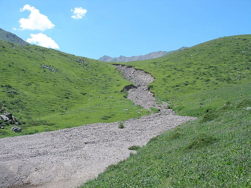
The Koltor lake was visited in 2004, three days after a rapid rise in water level caused by torrential rains. The consequent overspill led to acute danger of failure of the dam. The pattern of overflow was traced by deposits of fine clayey sediments on plants. Spasmodic overflow caused redevelopment and deepening of the erosion gully on the outer slope of the dam. If further deepening of the gully had occurred, then that part of the dam under the highest pressure could have been further weakened so that prolapse of material from the bottom part of the dam could have taken place, leading to rupture and emptying of the lake. Considering the volume of water and material in the dam, such a rupture would have a catastrophic impact on the whole Kegety valley and even the town of Tokmok located in the Chu valley would be affected.
Detailed studies at the dam and in the areas of the valley immediately above and below the lake were undertaken during the following year.
The investigation consisted of:
-
new bathymetric measurements and mapping of the lake basin using an echo depth finder
-
daily measurements of water discharge into the lake at the point of inflow
-
measurements of water level fluctuation
-
survey of the longitudinal profile of the Koltor river valley above the lake
-
surveying the profile of the lake dam
-
surveying of the erosion gully on the outer slope of the lake dam
-
survey of the longitudinal profile of the stream which would originate in the case of rupture of the lake dam
-
surveying of transverse profiles in lower part of the Koltor river valley (to enable modeling of the flood wave)
-
geophysical measurements on the lake dam
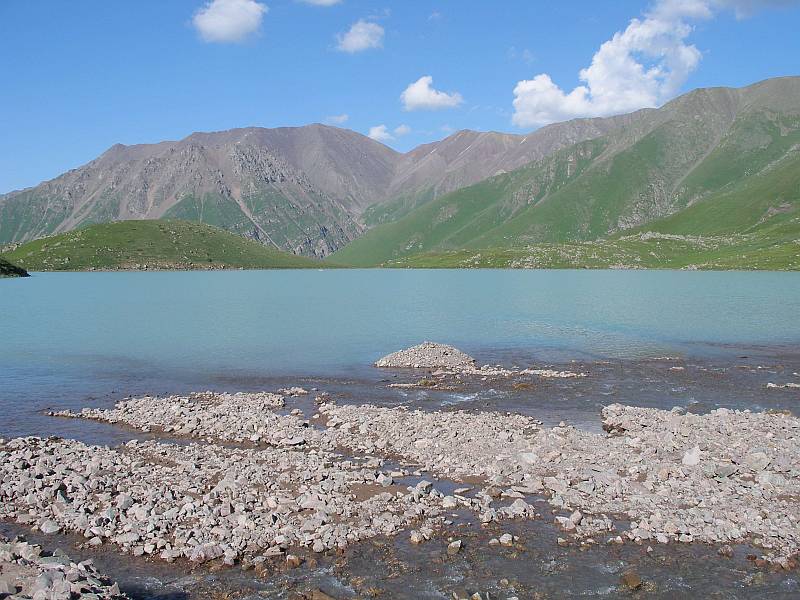
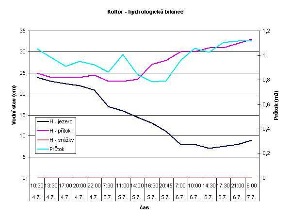
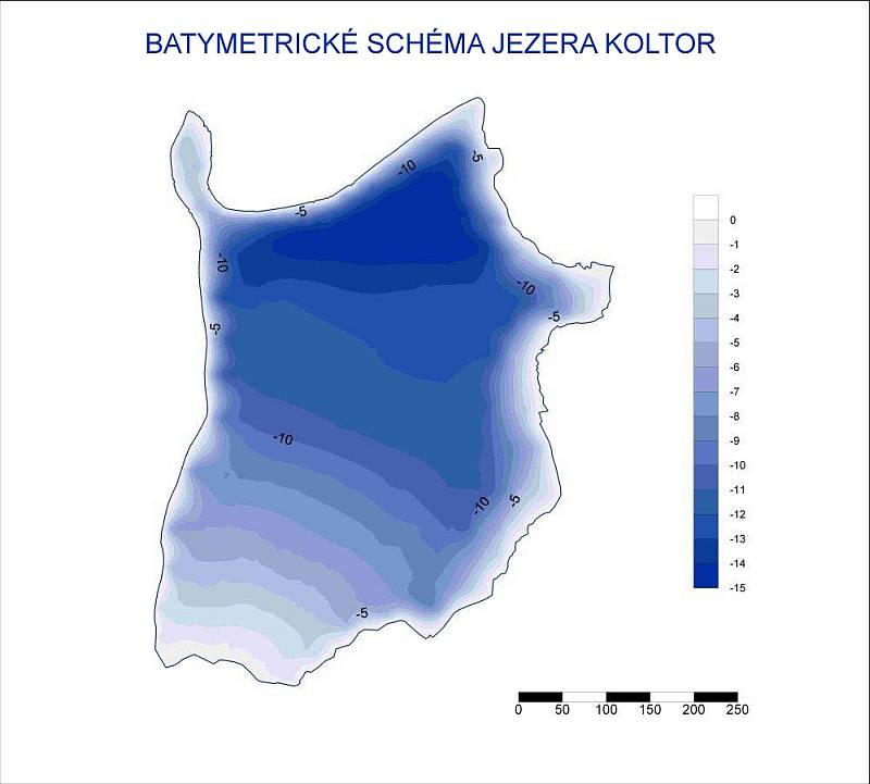
After evaluation of the morphometric parameters of the lake basin (see Table) it can be concluded that the area, volume and other hydrographic characteristics of the lake are dependent on the water level. Our results based on very detailed measurements of the shoreline using a total surveying station (model Leica) and bathymetric measurements made using an echo depth finder are based on the elevation of 2 726 m above sea level for the water level during the period of the survey from July 4 – 7, 2005 when the level was short by 1.5 m of the lowermost point of overspill. At this state of water level, the lake had an area of 22.15 hectares and a capacity of 1 830 000 m3 with a mean depth of 8.3 m.
Basic morphometric parameters of the Koltor lake measured during the years 1966, 1997 and 2005
|
Morphological parameters |
1966 |
1997 |
2005 |
| Elevation in m a.s.l. |
2726 |
2728 |
2726 |
| Area (ha) |
20 |
32,2 |
22,15 |
| Capacity (ths m3) |
1800 |
2600 |
1830 |
| Length (m) |
715 |
728 |
740 |
| Width (m) |
335 |
442 |
470 |
| Max. depth (m) |
14 |
15,9 |
14,8 |
| Mean depth (m) |
9 |
8,1 |
8,3 |
Source: Turbin, Kostjenko (1966), Jerokhin, Aleshin (1997), Geomin team (2005)
The At-Dzhailoo lake
The glacial moraine lake At-Dzhailoo lies below the glacier in the valley which joins the Kegety from the west. The 11 km long valley opens at an altitude of 2 210 m a.s.l. rising to about 3 800 m a.s.l. The lake water level is at 3 840 m a.s.l. The snout of the glacier is currently at a distance of about 150 – 200 m from the lake shore. Adjacent partly glaciated ridges attain an altitude around 4 000 m, with the highest peak 4 215 m a.s.l.
Access to the lake is relatively difficult, but at present conditions is worse because the normally passable road has been swept away by recent torrential rains and rock avalanches. The effects of floods and debris avalanches can be seen all along the road where river banks and culverts are damaged, and also at the center of Priut At-Dzhailoo in particular, which was visited by tourists and alpinists until recently. The lake is about 100 x 80 m in area with a maximum depth of 9 m and a volume of about 80 000 m3. The dam broke through in 1997. The water volume at that time was estimated to have been 120 000 m3, with a discharge rate of 20 m3/s. The danger from this lake was ranked as category 2, but this can change according to fluctuation of the water level and discharge conditions.
Surveying of the shoreline relative to fixed stations erected around lakeshore was carried out during the field season 2004, and investigation of the lake dam and discharge conditions showed that the water level was below its mean level. A new underground channel in the moraine dam has recently formed. This is believed to increase the probability of the rupture of the dam.
Detailed infestigation work was carried out in 2006.
Lakes in the Issyk-Ata valley
The Issyk-Ata valley is located about 40 km SE of the capital Bishkek. It is well-known for thermal springs and spa facilities which were, in the past, a popular venue for citizens of the former Soviet Union. At present, the majority of buildings are deteriorating due to a lack of money for maintenance but it is still a popular location for recreation and curative stays. A beautiful valley starts above the spa and extends for 25 km as far as the glaciated parts of the Kyrgyz range. Active debris avalanches occasionally block particular side valleys so that temporary lakes are formed. Conditions in these lakes are very unstable and they are prone to burst from their dams.
Three lakes occur in the central part of the Issyk-Ata river:
1. Ajak-Kol - at an altitude of 2 720 m a.s.l. has an estimated maximum surface area of 100 000 m2, and a volume of 200 000 m3. The water level is low at present, and because of the small volume of accumulated water, the lake was classified as being safe. However, further blockage of the river valley is likely to take place from both side valleys.
2. Orto-Kol - at an altitude of 2 990 m a.s.l. has an estimated maximum surface area of 150 x 103 m2, and a volume of 300 x 103 m3. The middle lake formed at the point of widening of the river valley and it is dammed by debris washed down from side valleys. The lake is thought to be in its final stage of development, having been gradually filled with sediments from the point of inflow and its discharge has been further decreased by erosion.
3. Minžilki - at an altitude of 3 120 m a.s.l. This is considered to be a lake with a potentially high risk of failure and was the subject of investigations during 2005.
The basins of all three lakes are blocked by debris-flows and rock glaciers from side valleys and/or gravitational talus. After their formation, the lakes were rapidly filled with water that spilled over the lowest point of the dam and discharge followed. The dam was gradually washed out and the lake was emptied. Because some of the rock avalanches and landslides are large, the water could have been retained for a few years or even decades. In such cases, a sequence of lacustrine sands and gravels 1-3 m thick were deposited from the river Issyk-Ata. Maximum depths of 5-6 m (on average cca 2 m) were measured during the whole period that the lakes were monitored.
The upper lake is the youngest in origin, thus illustrating the dynamic processes of formation and decline of the lakes blocked by rock avalanches. This lake did not exist in 1995, but was recorded for the first time two years later during a low helicopter flight. This lake cannot be more than ten years old. The lake is blocked by two interconnected rock glaciers from side valleys. A debris-flow occurred in the mid-nineties, originating from the left side valley. This covered the initial surface discharge of the lake which was transformed into the present underground discharge. The flow through the underground channels is cca 8 m3/s but the inflow into the lake in August was estimated at 35-40 m3/s. Thus there is a large inflow and little discharge from the lake basin and it has been filled rapidly. The capacity at the end of August was about 600 – 650 ths m3 and the water level was 1.3 m below the lowest point of the dam edge.
The water level during our measurements in August 2005 was a few centimeters below the lowest point of the dam. The maximum depth was 5.7 m. If the water flows over the dam then it could be washed out to form an erosion gully through which about 45 m3/s of water would be discharged. The discharge from a lake that burst in this way will increase due to side inflows (Baty, Chon-i Kichi Partak), mixing with debris material and inflow of water from underground channels. The discharge in the vicinity of the Issyk-Ata spa might be as high as 80-100 m3/s, posing a great danger for the spa and recreation facilities.
The Chayish lakes lie in the upper part of the Chayish valley in the catchment of the Karabalta river, near the Tuyu-Ashoo pass, cca 80 km WSW of the city of Bishkek. A tunnel was dug below the pass at an altitude of 3 115 a.s.l. This is the longest underground construction in Kyrgyzstan. A high quality asphalt road crossing the pass is the only road connecting the Chu region and areas to the south.
These lakes are typical moraine lakes with stable dams. The Upper Chayish lake is at an altitude of 3 239 m a.s.l., the Lower Chayish lake lies at 3 186 m a.s.l.
A field reconnaissance was undertaken in 2004. Detailed bathymetric and shoreline measurements were carried out in 2005. The Lower lake is supplied by surface water from the Upper lake. The Lower lake is drained via underground channels. Bathymetric measurements showed the maximum depth of the Upper and Lower Chayish lakes to be 4.8 m and 8.6 m respectively.
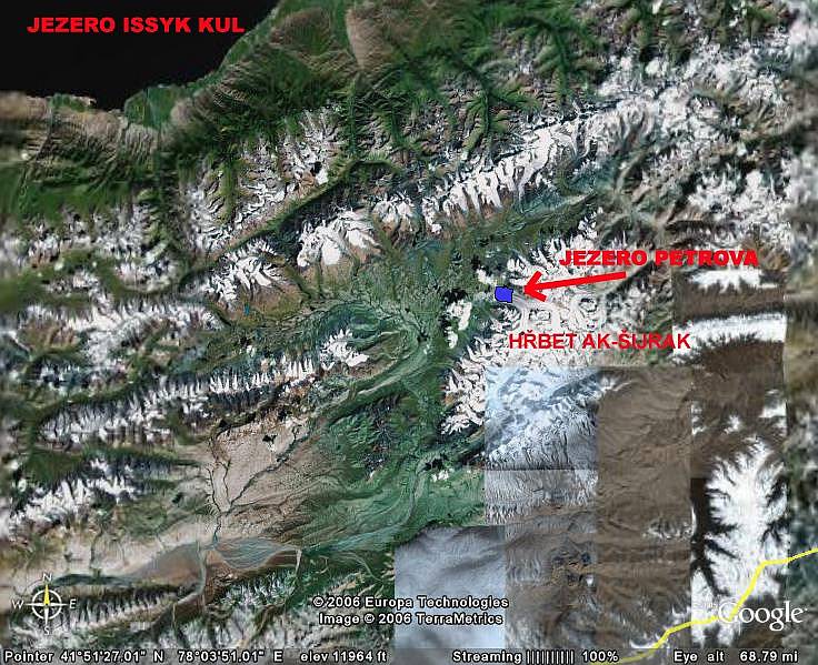
The Petrova lake
In 2005, the Geomin research team was asked by the Kyrgyz Ministry of Emergency to make an immediate assessment of the conditions of the Petrova lake and its dam. The reason was the extremely dynamic development of the lake that led to a rapid rise in its level and volume and, in particular, its proximity to a tailings pond containing cyanides from the ore dressing facility of a gold deposit that lies about 2 km downstream from the dam. The danger is that if the lake bursts, the tailings pond may rupture or it may overflow the side dam formed by natural Pleistocene moraine so that the harmful tailings could be spread along the river Naryn which rises nearby and flows across the whole of Kyrgyzstan. Regardless of this aggravating environmental problem, a simple rupture of the lake would still cause an immense catastrophe.
Because of the size of the lake, technical problems and the time available, it was not possible to carry out an investigation of the whole lake, and only critical sites were studied. These were, in particular, the sub-lake mentioned above, thermokarst lakes in the body of the dam and the weakest point on the dam.
Geographical position
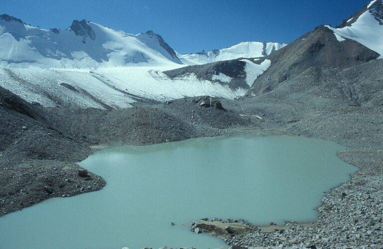
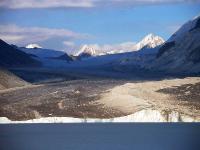
The Petrova lake lies in the front of the Petrova glacier on the north-western slope of the Ak-Shiriak massif in the Central Tien-Shan. It is the largest glacier in the entire drainage of the river Naryn. This valley glacier covers an area of 69.8 km2 and is over 23 km long. Based on aerial photogrammetry from the year 1995, undertaken by the Aero Map U.S. Company the area of the lake surface was 278.4 hectares. Maximum measured depth was 24 m and a mean depth of 8.3 m.
The Petrova lake is supplied by water from the Petrova glacier. The snout of the glacier calves directly into the lake delivering a volume of about 119 km3 of ice a year. This represents an average inflow of about 3.7 m3/s. The Petrova lake is drained by the Kumtor river that is the major tributary of the river Naryn. According to the records of the Tian-Shan hydrometeorological station, the discharge of the river during the period June-September fluctuates between 2.9 – 25.2 m3/s. From approximately the end of October until the end of April, the river freezes through to its bed and the outflow from the lakes stops completely.
Summary of work undertaken in the area of the Petrova lake in July 2005
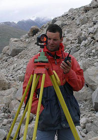
- surveying a plan of the moraine dam using a Leica total geodetic station (model TCR 705) on the inner and outer side of the dam
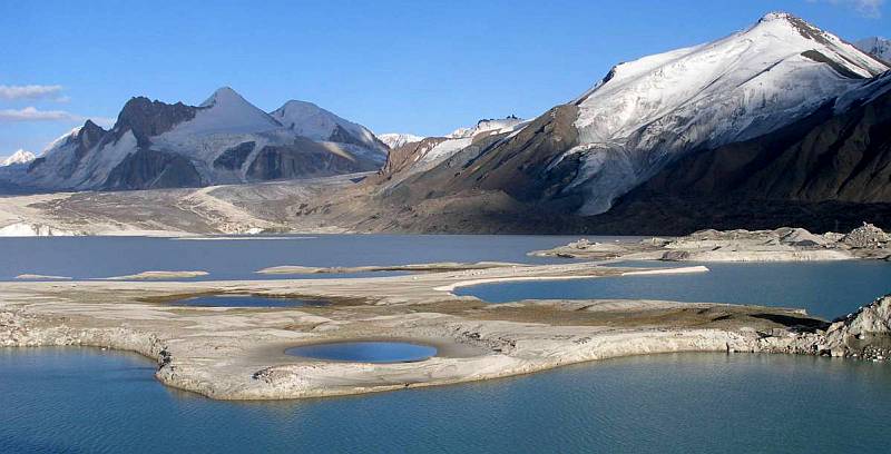
- surveying of the shorelines of thermokarst lakes in the central part of the moraine dam which is most in danger of rupturing (Fig.6)
- systematic bathymetric measurements of 22 lakes within part of the Petrova lake dam
- construction of longitudinal profile of the dam along the main crest line, and of a few cross sections in the central weakened part of the dam
- geomorphological assessment of the stability of meso- and microrelief features in the dam area
- measurements of principal physical and chemical parameters of the accumulated water along a vertical profile (water temperature, dissolved oxygen, saturation by oxygen, conductivity, pH, salinity) using a multiparametric probe (YSI 6920)
- comparative study of historical maps, aerial and satellite photographs to determine the pattern of changes over time
- study of historical literature from the time of the earliest expeditions
- a combination of geophysical measurements carried out over the most critical sections of the dam
Major results achieved during the investigation of the Petrova lake in 2005
a) Thermokarst processes triggered by thawing of buried ice are very dynamic. This has led to considerable expansion and deepening of lakes within the lake dam itself. New masses of the buried glacier are repeatedly exposed on the shores of these lakes so that the inclination of these slopes often exceeds the critical value. This contributes to further deepening of the thermokarst lakes.
Narrow strips of dry land between individual lakes are continually sinking and gradually changing into shallows and channels. In such a way, a number of lakes inside the dam body have become interconnected. A large lake in the north-eastern part of the dam, the so-called Blue bay, is intensely affected by these processes. Since the last survey undertaken in 1995, its surface has increased to reach 8.76 hectares and it now contains 745 569 m3 of water with a maximum depth of 21.1 m and an average depth of 5.14 m. This bay penetrates deeply into the body of the dam and dissects it. The dam at this point has already been weakened. The direct distance between the bay shore and the outer slope of the dam at the water level is only 63 meters. The profile across the dam showed that the bottom of the Blue bay lies about 9 m above the alluvial plain level of the river Kumtor below the dam. A depression connected with the lowest level of the dam being only 11.9 m above the water level is to be also noticed.
Moreover, based on the results of geophysical measurements, approximately 70% of the narrowed central part of the dam is formed by buried ice that is disturbed by numerous cracks and is thawing rapidly, as can be seen even at the surface. Some of the steep slopes of the thermokarst lakeshores are thawing and pebbles and even large blocks of rock are released from them intermittently and fall into the lakes. All these processes endanger the stability of the dam and increase the possibility of its rupture.
b) The second phenomenon that increases the possibility of dam rupture is the rapid increase in its surface area and in the volume of retained water. Global warming is causing thawing and retreat of the large Petrova glacier. The lake in front of the retreating glacier becomes larger and, at the same time, contributes to faster melting of the glacier.
At present, the Petrova lake is among the most risky alpine lakes in Kyrgyzstan and perhaps even in the whole of Central Asia. The reason for this is its rapid dynamic development and the large volume of water contained. For this reason, great emphasis will be placed on investigations of this lake during future follow-up projects.
In 2006, which is the last year of the three-year project, further field investigations of selected lakes were carried out. The field work continued from the end of May until the beginning of August.
The following localities were studied
The Chok-Tal lakes
The Chok-Tal 1 and Chok-Tal 2 lakes are located in the Issykkul region in the northern part of Kyrgyzstan on the southern slopes of theTerskey Ala-Too ridge. These were the first sites investigated. These lakes were selected because of their southern aspect, assuming that in early June they would not be frozen anymore. However, due to an extraordinarily cold spring the Chok-Tal 1 was still frozen so that bathymetric measurements could not be carried out. During our visit, the Chok-Tal 2 lake was almost dry because the water had been drained through open channels and the level of water remaining indicated that the supply of water from the progressively retreating glaciers has declined, leading to reduction in the danger from the lakes in this area.
The Chon-Kemin valley
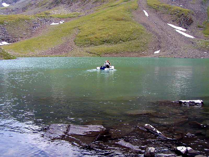
The Kol-Kogur lake in the Chon-Kemin valley (The Chu region) about 150 km east of the capital Bishkek was selected for further investigation. It is dammed up by a landslide and lies on the northern slopes of the Ak-Shiyrak range. The increasing danger from lakes of this type and absence of data on the state of its dam were the reason for the investigation. Only a brief reconnaissance of the Kol-Tor lake was made because, due to the swollen river, it was impossible to bring the necessary equipment and supplies. New equipment (a motorboat, and echo sounder with GPS) was tested on the small Dzhashyl-Kol lake nearby. This equipment will be used for critical investigations of the Petrova lake
The Nooruz glacier
The Nooruz glacier lies about 50 km south-east of the city of Bishkek. Data on a number of thermokarst lakes formed on its large moraine have not been collected for the last decade. The two largest lakes were surveyed. Reconnaissance and monitoring of the conditions of the Cherkanak lake in the neighboring valley were also undertaken. During our visit, the level of water in the lake was very low.
The Adygine lakes
The Adygine lakes were briefly visited and monitored in late June. These lakes were studied in detail in the previous year. Dynamic changes in the front of glacier were proved. These have given rise to the formation of new lakes so the locality is now considered dangerous and deserves permanent monitoring.
The At-Dzhayloo lake
The At-Dzhayloo lake on the northern slopes of the Kyrgyz range was the final locality visited during the first half of the field program. The investigations included hydrological studies, bathymetric measurements, surveying of the shoreline and geomorphological mapping. This lake is in category 1 of the hierarchy of danger.
The Petrova lake
The research on this exceptionally dangerous lake continues to be a top priority of the Ministry of Emergency of the Kirghiz Republic. This extensive, rapidly developing lake containing a large volume of water is considered to be one of the most dangerous lakes, not only in Kyrgyzstan but in the whole of Central Asia. It lies in the area of the mining claim of the Canadian-Kyrgyz gold mine at Kumtor. If this lake fails, it would damage part of the mine infrastructure and, under certain conditions, it would threaten the adjacent tailings pond. Consequently, the mining company was extremely interested in the results of the investigations which are to be financed largely by the Kyrgyz counterpart.
The investigation of the site was focused on the critical section in the narrowest part of the dam and also on the bay which intrudes and weakens the dam. The dam was subjected to a range of geophysical measurements using geoelectric methods, microgravimetry and ground penetration radar. A hydrogeological survey and assessment of changes that had taken place since the previous year were made. Discharges on outflow and all inflows were measured and the bathymetry of selected thermokarst lakes on the dam was measured. A dense grid of bathymetric measurements was carried out in the main lake. Glaciological and geomorphological studies were undertaken on the snout of the glacier. Supplementary methods were applied to study the retreat of neighboring glaciers by measuring the physical properties of water and collecting biological samples.
The first surprise resulting from the investigation was the shape of the lake basin and the maximum measured depth. The basin was found to consist of two elongate sub-basins separated from each other by a mostly submerged ridge. The southern sub-basin is shallower and more regular, whereas the northern sub-basin is deeper and more rugged and the last third of it at the front of the glacier deepens sharply. In the past, the depth of the lake was considered not to exceed 20 m, but our measurements showed the maximum depth to be 69.3 m which may be even greater in the immediate proximity of the glacier. However, here the measurements were too risky to undertake because blocks of ice were breaking off.
Our recent investigation confirmed the rapid development of lake area and extremely fast glacier retreat. The study of lake history using the aereal photographs and space images approved growing dymamics of this phenomena. During the last 50 years, the area of the lake has expanded 4 times and, during the recent period (from 1999 to 2006), the water surface has been increasing by more than 9 ha a year. The glacier retreat reached the mean speed of 61.4 m during last eight years.
The results of the geophysical measurements proved that massive ice is buried in the lake dam and that there are weakened zones inside the ice mass.
KUTMAN-KUL lake
The Kutman-Kul lake located in in the Dzhalalabad region in the south of Kygyzstan was the last locality investigated. The lake, which was briefly studied in 1966, is located ca 40 km above the abandoned uranium deposit at Maili-Suu. There was anxiety that if the lake ruptured, the water could damage the tailings pond containing radioactive waste. A field reconnaissance was undertaken to assess the state of the dam and the possible risks. If some hazardous phenomena were identified, a detailed exploration project would have been designed. However, the dam was found to be very stable and no threat from exogenous phenomena in the immediate neighborhood were identified. It was concluded that the dam is unlikely to fail and so no detailed studies are needed at present.
All measurements and observations made during the field program are now in the process of interpretation and will be summarized in the Final Report which is due to be compiled in November 2006. The report will be handed over to the clients, The Ministry of the Environment of the Czech Republic and the Kyrgyz authorities.